
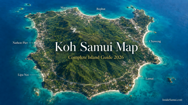
A good Koh Samui map is the single most useful planning tool you can have before arriving on the island. Koh Samui is larger than most visitors expect — 228 km² of coastline, jungle interior and mountain ridge — and the distances between the main beach areas are significant enough that choosing the wrong base can cost you two hours a day in taxi rides. This complete Koh Samui map guide covers every area of the island in 2026: where the beaches are, where the piers sit, where the best hotels and restaurants are located, and exactly how to navigate the 51 km ring road that circles the entire island.
East — Chaweng & Lamai
South — wild & quiet
West — sunset & ferry
Tap a zone or pin to explore
Koh Samui breaks down into four coastal zones around a jungle interior. Tap any area of the map for what's there, where to stay and how to get around.
According to the Tourism Authority of Thailand, Koh Samui covers 228.7 km² — making it Thailand's third largest island after Phuket and Koh Chang, and significantly larger than it appears on standard tourist maps.
The island is bigger than it looks — the drive from Nathon (west) to Chaweng (east) is 30–35 minutes, and taxis add up fast at 200–600 THB per hop. A rental car reaches every beach, waterfall and viewpoint on this map, works out cheaper per day than repeated taxis, and comes with full insurance when booked online.
Koh Samui Map — Island Overview
Island size: 228.7 km² · Coastline: 51 km (ring road) · Highest point: Khao Pom 635m · Main beach areas: 8 · Airport: Northeast coast (USM) · Main pier: Nathon (west coast) · Shape: Roughly oval, mountains in centre
The Koh Samui map is best understood as a series of distinct coastal zones surrounding a mountainous jungle interior. The ring road (Route 4169) circles the entire island at low elevation, connecting all the main beach areas. The interior is largely undeveloped jungle — the Na Muang waterfalls are the main reason visitors venture inland. Understanding the Koh Samui map orientation is essential: the airport is on the northeast coast, the main ferry pier is on the west coast, and the most popular beaches are on the east and north coasts.
Koh Samui Map — The Ring Road Explained
The 51 km ring road is the backbone of the Koh Samui map — the single road that connects every beach, every town and every attraction on the island. Driving it by scooter or car is one of the best ways to understand the island's geography. Here is the complete ring road circuit clockwise from Nathon Pier:
| Section | Distance | Drive Time | Key Stops on Koh Samui Map |
|---|---|---|---|
| Nathon → Maenam | 8 km | 15 min | Nathon town · Lipa Noi beach · Maenam village |
| Maenam → Bophut | 5 km | 10 min | Maenam beach · Bang Rak pier · Big Buddha |
| Bophut → Chaweng | 7 km | 12 min | Fisherman's Village · Chaweng Lake · Chaweng beach |
| Chaweng → Lamai | 8 km | 12 min | Chaweng Noi · Silver Beach · Coral Cove |
| Lamai → Thong Krut | 10 km | 20 min | Hin Ta Hin Yai · Na Muang waterfalls turnoff · South coast |
| Thong Krut → Nathon | 13 km | 25 min | Taling Ngam · Lipa Noi · West coast viewpoints |
Drive the ring road clockwise — you keep the sea on your left for most of the circuit, which gives you better views and easier beach access. Start at 7am from Nathon to catch the west coast in the morning calm, reach Chaweng by 9am and Lamai by 10am. The south coast section (Lamai to Thong Krut) has the most dramatic scenery and fewest tourists.
Koh Samui Map — North Coast
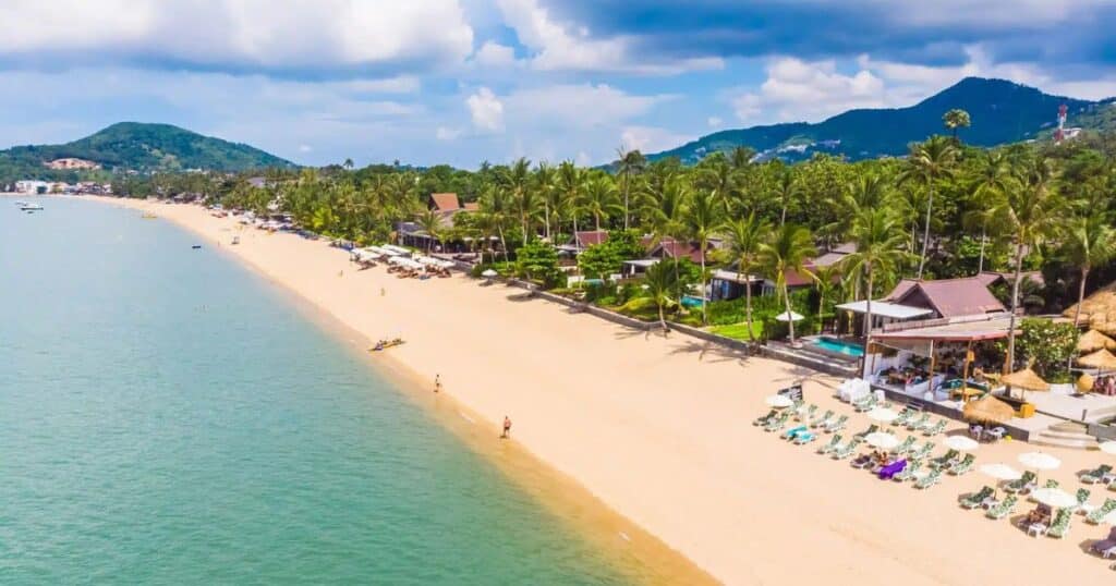
The north coast runs from the airport area west through Bophut and Maenam to the top of the island. It is the most civilised and characterful stretch of coastline — the expat community's favourite, the location of the island's best weekly market (Bophut Friday Night Walking Street), and home to the Four Seasons Resort, the finest hotel on the island.
Key locations on the north coast:
- Maenam Beach — 4 km of flat, calm beach. Best for families. Monday Night Market in the village.
- Bophut / Fisherman's Village — original Sino-Portuguese shophouses. Friday Night Market. Best restaurants on the north coast.
- Bangrak Pier (Big Buddha Pier) — ferries to Koh Phangan and Koh Tao. Walking distance from the Big Buddha temple.
- Big Buddha Temple (Wat Phra Yai) — 12-metre golden Buddha on a small island causeway. Most visited temple on the Koh Samui map.
- Wat Plai Laem — 18-armed Guanyin statue on a lake. Less visited than Big Buddha but equally impressive.
Bophut and Maenam are the north coast's best bases — calm beaches, great food, walkable Fisherman's Village. Rooms near the Friday market book out early in high season.
Koh Samui Map — East Coast

The east coast is the most developed and most visited section of the island — dominated by the 7 km arc of Chaweng Beach and the 4 km strip of Lamai Beach. This is where the island's main tourism infrastructure is concentrated: the most hotels, the most restaurants, the most water sports and the main nightlife strip. The airport (USM) sits at the northern end of the east coast.
Key locations on the east coast:
- Koh Samui Airport (USM) — northeast corner of the island. Taxis to Chaweng: 15 min. To Bophut: 15 min. To Lamai: 35 min. To Nathon Pier: 40 min.
- Chaweng Beach — the longest and most complete beach on the island. Main tourist strip. Airport 15 min north.
- Chaweng Lake — freshwater lake behind the north end of Chaweng Beach. Marks the quiet northern end of the strip.
- Silver Beach (Ao Thong Takian) — secluded cove between Chaweng and Lamai. Accessible via steep track off the main road.
- Coral Cove — small rocky cove with the clearest water on the east coast. Best snorkeling directly from shore.
- Lamai Beach — second major beach on the east coast. More local, less commercial than Chaweng.
- Hin Ta Hin Yai — Grandmother and Grandfather Rocks at the southern end of Lamai. Famous geological formation.
Koh Samui Map — South Coast
The south coast is the least developed and most authentic stretch of coastline — a largely undiscovered stretch of coastline that most tourists never reach. The road here climbs through jungle, drops past local fishing villages and delivers some of the most spectacular scenery on the island. The Na Muang Waterfalls are accessed via a road cutting north from the south coast into the island interior.
Key locations on the south coast:
- Na Muang Waterfall 1 & 2 — access road off the south coast ring road. Na Muang 1: 5-min walk. Na Muang 2: 20-min jungle hike. Both free.
- Wat Khunaram — temple with the preserved body of a mummified monk. South coast road, between Lamai and Thong Krut.
- Hua Thanon village — Muslim fishing village with the best southern Thai halal food on the island. Excellent morning market.
- Thong Krut Beach & Pier — authentic fishing village. Departure point for Five Islands longtail boat trips.
- Bang Kao Beach — completely undeveloped beach. No facilities. One of the wildest spots on the Koh Samui map.
No songthaew or bus serves most of the south coast — Na Muang, Wat Khunaram, Hua Thanon and Thong Krut are only practical with a car or scooter. This is the part of the map where independent transport turns a missed corner of the island into the highlight of your trip.
The south coast section of the Koh Samui map is best experienced on a ring road day — the road climbs and drops dramatically through jungle with occasional sea views that are genuinely spectacular. Stop at Wat Khunaram (free), the Hua Thanon Muslim market (morning only), and Thong Krut for a fresh seafood lunch before continuing west.
Koh Samui Map — West Coast
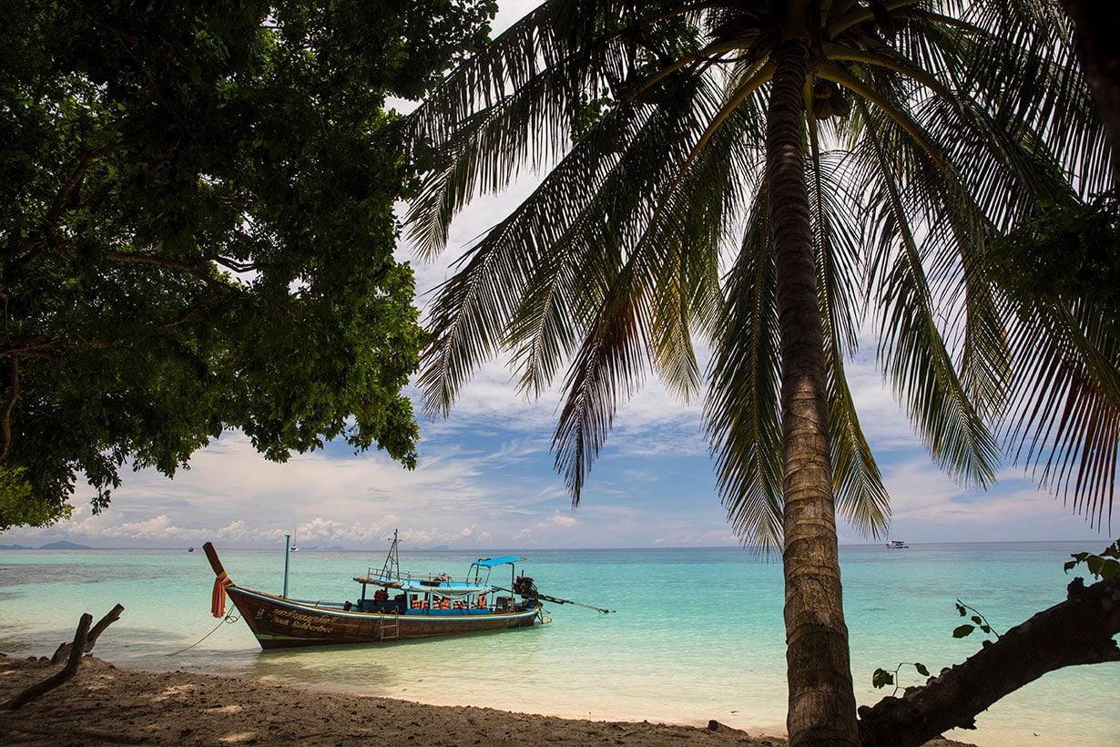
The west coast is the sunset coast — facing directly west over the Gulf of Thailand toward the limestone islands of Ang Thong Marine Park. It is the quietest and least touristy section of the coastline, home to the main ferry pier at Nathon and some of the island's most dramatic sunset views. The InterContinental Koh Samui and Nikki Beach Resort are both on the west coast.
Key locations on the west coast:
- Nathon Pier — the main ferry terminal on the Koh Samui map. All mainland ferries (Raja, Seatran, Lomprayah) depart from here. Ferry to Surat Thani/Donsak: 1h–1h30.
- Nathon Town — the island's administrative capital. Best local food market. Least touristy town on the island.
- Taling Ngam Beach — best sunset beach on the Koh Samui map. West-facing. InterContinental hotel here.
- Lipa Noi Beach — quiet, golden sand beach. Local fishing village. No tourist facilities — bring everything.
- Ang Thong Marine Park — visible on the horizon from the west coast. 45 min by speedboat. Day trips depart from various piers.
Get Around Every Corner of the Map
Car for comfort & the south coast · Scooter for cheap island hops
Koh Samui Map — Distances Between Key Points
| From | To | Distance | Taxi Price | Drive Time |
|---|---|---|---|---|
| Airport (USM) | Chaweng Beach | 10 km | 200–300 THB | 15 min |
| Airport (USM) | Bophut / Fisherman's Village | 8 km | 150–200 THB | 12 min |
| Airport (USM) | Maenam Beach | 12 km | 200–250 THB | 18 min |
| Airport (USM) | Lamai Beach | 24 km | 450–600 THB | 35 min |
| Airport (USM) | Nathon Pier | 30 km | 550–700 THB | 40 min |
| Chaweng | Bophut | 8 km | 150–200 THB | 15 min |
| Chaweng | Lamai | 8 km | 150–200 THB | 15 min |
| Chaweng | Nathon Pier | 25 km | 300–500 THB | 30 min |
| Chaweng | Na Muang Waterfall | 14 km | 300–400 THB | 20 min |
| Lamai | Thong Krut Pier | 12 km | 250–350 THB | 20 min |
| Nathon Pier | Maenam | 8 km | 150–200 THB | 12 min |
Look at the taxi column: two or three trips a day and you've spent 1,000–1,500 THB before you've done anything. A rental car covers all of it — every row of this table — for less per day, with the freedom to stop anywhere on the map.
Koh Samui Map — The 5 Main Piers
| Pier | Location on Map | Routes | Operators |
|---|---|---|---|
| Nathon Pier | West coast | Mainland (Donsak/Pralarn) | Raja · Seatran · Lomprayah |
| Lomprayah Maenam Pier | North coast | Koh Phangan · Koh Tao · Chumphon | Lomprayah only |
| Bangrak Pier | North-east coast | Koh Phangan · Koh Tao | Songserm · Speedboats |
| Chaweng Pier | East coast | Day trips · Ang Thong tours | Tour operators |
| Thong Krut Pier | South coast | Five Islands · Ang Thong | Longtail boats |
🗺️ Book Ang Thong & Island Tours — GetYourGuide →
Koh Samui Map — Key Attractions by Location
| Attraction | Location | Entry | Time Needed |
|---|---|---|---|
| Big Buddha Temple | North coast, Bangrak | Free | 1–2h |
| Wat Plai Laem | North coast | Free | 30–60 min |
| Na Muang Waterfall 1 | South interior | Free | 1–2h |
| Na Muang Waterfall 2 | South interior | Free | 2–3h |
| Hin Ta Hin Yai (Rocks) | South Lamai | Free | 30 min |
| Wat Khunaram | South coast road | Free | 30 min |
| Ang Thong Marine Park | Off west coast (boat) | Tour price | Full day |
| Bophut Friday Night Market | North coast | Free | 2–4h |
| Chaweng Night Bazaar | East coast | Free | 1–2h |
| Hua Thanon Muslim Market | South coast | Free | 1h |
How to Navigate the Koh Samui Map
The island is straightforward to navigate once you understand the basic geography. Here are the tools and tips that make getting around easy:
Google Maps on Koh Samui: Works excellently across the entire island. Download the offline map of Koh Samui before arriving — this is the most important navigation step on the Koh Samui map. An offline map means you navigate without using mobile data and without needing a signal in the occasional dead spots on the south coast road.
The ring road logic: Almost everything on the Koh Samui map is on or near the ring road (Route 4169). If you know which direction your destination is from your current position, you can find anything. Clockwise from Nathon: north coast → east coast → south coast → west coast.
Grab app: Works across the island and shows real-time driver locations on the map. Consistently 15–20% cheaper than negotiated taxis. Download and set up before arriving using your Thailand eSIM which activates the moment you land.
Car rental: The most comfortable way to use the Koh Samui map independently — air-con, luggage space, and access to the whole island including the south coast that no bus serves. Compare all local suppliers via Discover Cars for the best rate with free cancellation.
Scooter rental: The cheapest way to explore the map independently for confident riders — from 150 THB/day, delivered to your hotel. Message us on WhatsApp and we'll sort a trusted local scooter for you. The full ring road circuit takes 2.5–3 hours without stops.
The island is bigger than it looks on a standard tourist map. The drive from Nathon Pier (west) to Chaweng Beach (east) takes 30–35 minutes on the ring road — not the 15 minutes that many visitors assume. Always factor travel time into your planning, particularly if connecting a mainland ferry arrival at Nathon Pier with accommodation at Lamai or further south.
Koh Samui Map — Interactive Navigation Tips
- Save key locations before arriving: In Google Maps, save Nathon Pier, your hotel, the Big Buddha, Na Muang Waterfall, and Bophut Fisherman's Village before you fly. These five points cover essential navigation and let you orient yourself immediately on arrival.
- GPS coordinates for Nathon Pier: 9.5349°N, 100.0588°E — the starting point for all mainland ferry journeys.
- Airport GPS coordinates: 9.5478°N, 100.0616°E — northeast corner of the island.
- Big Buddha GPS: 9.5644°N, 100.0655°E — north coast, near Bangrak Pier.
- The interior mountain road: There is a road across the mountain interior connecting the north coast to the south coast directly — approximately 12 km but significantly slower than the ring road. Scenic but requires a confident rider on the steep sections.
FAQ — Koh Samui Map
How big is Koh Samui?
Koh Samui covers 228.7 km² — larger than most visitors expect. The ring road around the entire island is 51 km and takes approximately 2.5–3 hours by scooter without stops, or 1.5–2 hours by car. The island is roughly oval in shape with a mountainous jungle interior and a coastal ring road connecting all the main beach areas.
Where is the airport on the Koh Samui map?
Koh Samui Airport (USM) is located on the northeast corner of the island, between Bophut and Chaweng on the north-east coast. It is approximately 10 km from Chaweng Beach (15 min taxi), 8 km from Bophut (12 min), 12 km from Maenam (18 min), 24 km from Lamai (35 min) and 30 km from Nathon Pier (40 min).
Where is the pier on the Koh Samui map?
The main pier on the Koh Samui map is Nathon Pier on the west coast — the departure point for all mainland ferries to Surat Thani Province (Donsak and Pralarn piers). Koh Samui also has four other piers: Lomprayah Maenam Pier (north coast, island hopping), Bangrak Pier (north-east, Songserm ferries), Chaweng Pier (east coast, day trips) and Thong Krut Pier (south coast, Five Islands).
How do I get around Koh Samui without a map?
The ring road logic makes it easy — if you know you are going clockwise or anti-clockwise from your current position, you can navigate the entire island without a detailed map. Most locals can direct you by landmark (Big Buddha, Chaweng Lake, Nathon Pier) rather than road names. Google Maps works excellently across the island — download offline for best results.
What is the best way to explore the Koh Samui map?
The best way to explore the Koh Samui map independently is by rental car or scooter — a car gives you comfort and reaches the whole island including the south coast, while a scooter (from 150 THB/day) is the cheapest option for confident riders. The full ring road circuit takes 2.5–3 hours without stops. For those who prefer not to drive, the Grab app gives transparent pricing for taxis to any point on the map.
Continue Reading
- 35+ Best Things to Do in Koh Samui 2026
- Best Beaches in Koh Samui — 10 Ranked
- Where to Stay in Koh Samui — Best Area Guide
- Pier Koh Samui — Complete Guide to All 5 Piers
- Car Rental Koh Samui — Best Prices 2026
- Best Time to Visit Koh Samui 2026
Some links are affiliate links. InsideSamui.com earns a commission via Discover Cars, Agoda and GetYourGuide at no extra cost to you. Map distances and drive times are approximate. Updated 2026.