
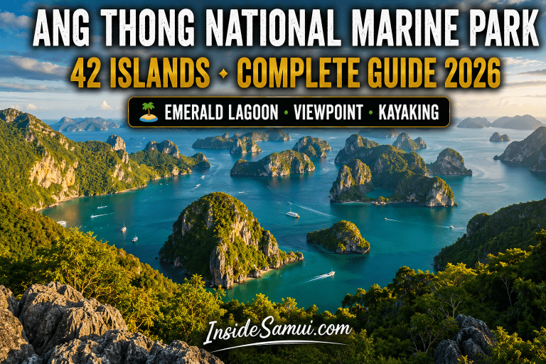
Ang Thong National Marine Park — officially Mu Ko Ang Thong National Marine Park — is a cluster of 42 limestone karst islands scattered across the Gulf of Thailand, roughly 30km north-west of Koh Samui. The park is widely regarded as the single most spectacular natural destination accessible from Koh Samui — dramatic vertical cliffs rising directly from emerald water, a hidden saltwater lagoon reached via jungle climb, and panoramic viewpoints over dozens of islands simultaneously.
This complete guide to Ang Thong National Marine Park covers everything for 2026 — the geography and history of the park, every major island and what makes it worth visiting, the best ways to get there, what a typical day trip involves, the finest sea kayaking and snorkeling in the Gulf of Thailand, and the honest information you need to plan an extraordinary visit.
According to Thailand's Department of National Parks, Wildlife and Plant Conservation, Mu Ko Ang Thong National Marine Park was established in 1980 as one of Thailand's earliest marine protected areas, covering approximately 102 km² of which the vast majority is open water and submerged reef — the islands themselves represent only a small fraction of the protected area.
🏝️ Book Ang Thong Marine Park Tour — GetYourGuide →
Ang Thong National Marine Park — Key Facts
| Detail | Information |
|---|---|
| Official name | Mu Ko Ang Thong National Marine Park |
| Established | 1980 |
| Number of islands | 42 |
| Total area | ~102 km² (mostly sea) |
| Location | Gulf of Thailand · ~30km north-west of Koh Samui |
| From Koh Samui (Na Thon Pier) | 1–1.5h by tour boat |
| National park entry fee | 300 THB (adults) · often included in tour price |
| Best season | December–April |
| Avoid | October–November (NE monsoon · tour cancellations) |
| Main island | Koh Wua Talap (park headquarters · viewpoint) |
Ang Thong National Marine Park — Why “Ang Thong” Means “Golden Bowl”
The name Ang Thong translates to “Golden Bowl” — a reference to the shape of the bay formed by Koh Mae Ko's hidden lagoon, Thale Nai, which when viewed from above resembles a bowl filled with emerald-green water surrounded by golden limestone cliffs. The “golden” element also reflects the warm colour of the limestone rock at sunrise and sunset, when the karst formations across the archipelago take on a distinctive golden-amber glow. This visual signature — golden cliffs rising from intensely turquoise and emerald water — is the defining characteristic of Ang Thong National Marine Park and the reason it consistently ranks among Thailand's most photographed natural landscapes.
Ang Thong National Marine Park — Geography and the 42 Islands
The 42 islands of Mu Ko Ang Thong National Marine Park are predominantly uninhabited limestone karst formations — the same geological process that created the dramatic landscapes of Phang Nga Bay and Krabi on the Andaman coast, but in the Gulf of Thailand. The islands range from small rock outcrops barely large enough to anchor a boat to substantial islands with beaches, forest cover and hiking trails. Most day trip itineraries focus on 2–4 of the largest and most accessible islands, since the remoteness and lack of infrastructure on most of the 42 islands makes them impractical for typical visitor access.
| Island | Significance | Activities |
|---|---|---|
| Koh Wua Talap | Park headquarters · Largest visitor infrastructure | Viewpoint hike · Beach · Visitor centre · Camping |
| Koh Mae Ko | Home of Thale Nai (Emerald Lagoon) | Lagoon viewpoint hike · Photography |
| Koh Sam Sao | Natural rock arch formation | Snorkeling · Kayaking through arch |
| Koh Tha Pang | Snorkeling reef | Snorkeling · Beach |
| Koh Hin Dap | Smaller karst formation | Kayaking · Photography |
| Koh Wao | Quieter alternative beach | Beach · Snorkeling |
Ang Thong National Marine Park — Koh Wua Talap (Main Viewpoint)
Koh Wua Talap — meaning “Sleeping Cow Island,” named for its silhouette when viewed from certain angles — is the park headquarters and the most visited island in Mu Ko Ang Thong National Marine Park. The island's defining feature is the viewpoint trail: a steep, challenging climb of approximately 430 metres that ascends through limestone terrain via a combination of stone steps and rope-assisted sections. The climb takes 30–45 minutes each way and is genuinely demanding — sturdy footwear is essential and the trail is not suitable for visitors with mobility limitations or young children.
The reward at the summit is one of the most extraordinary panoramic views in Thailand — a 360-degree vista over dozens of the park's limestone islands scattered across the Gulf of Thailand, with the deep blue sea contrasting against the green-forested karst formations below. This view is the single most photographed image associated with Ang Thong National Marine Park and frequently appears in Thailand tourism marketing. The viewpoint is best visited in the morning — both for cooler hiking temperatures and for the clearest visibility before any afternoon haze develops.
The Koh Wua Talap viewpoint trail gains approximately 430m in elevation over a steep, rocky path with sections requiring rope assistance. Allow 30–45 minutes up and 20–30 minutes down. Wear closed-toe shoes with grip — flip-flops are genuinely dangerous on this trail. Bring water — there is no shop at the summit. Most tour itineraries allocate 1–1.5 hours total for this activity, which is tight but workable for a moderately fit visitor.
Ang Thong National Marine Park — Koh Mae Ko and Thale Nai (Emerald Lagoon)
Koh Mae Ko is home to Thale Nai — the “Emerald Lagoon” — an enclosed saltwater lake connected to the sea via underground channels through the limestone, creating a body of water with a distinctive emerald-green colour that gives Ang Thong National Marine Park its “Golden Bowl” name. The lagoon is surrounded on all sides by steep limestone walls, creating a dramatic enclosed amphitheatre effect.
The lagoon itself is not accessible for swimming — visitors view it from an elevated viewpoint reached via a climb of approximately 240 steps through forest terrain. The viewpoint platform overlooks the full lagoon and surrounding cliffs, offering a different but equally striking perspective compared to the Koh Wua Talap panorama. Many day trip itineraries include both Koh Wua Talap and Koh Mae Ko, though time constraints sometimes mean tours offer a choice between the two viewpoint hikes rather than both.
Ang Thong National Marine Park — Snorkeling and Kayaking
Beyond the viewpoint hikes, Mu Ko Ang Thong National Marine Park offers excellent snorkeling and sea kayaking — activities that showcase the underwater and sea-level perspectives of the limestone landscape:
| Activity | Location | Highlight | Suitable For |
|---|---|---|---|
| Snorkeling | Koh Tha Pang · Koh Sam Sao reefs | Coral gardens · Reef fish · Clear water | All levels |
| Sea kayaking | Channels between islands | Limestone arches · Hidden coves | Beginners (guided) |
| Kayak through Koh Sam Sao arch | Koh Sam Sao | Paddle through natural rock arch | Beginners (guided) |
| Beach time | Koh Wua Talap · Koh Wao | White sand · Calm water | Everyone |
Sea kayaking through the narrow channels and natural arches between the limestone islands is one of the most memorable activities in Ang Thong National Marine Park — most tours provide two-person kayaks with a guide, making the activity accessible even for visitors with no prior kayaking experience. Paddling beneath overhanging cliffs and through the Koh Sam Sao rock arch delivers a sea-level perspective on the park's geology that the viewpoint hikes cannot provide.
Ang Thong National Marine Park — How to Visit
Virtually all visitors experience Ang Thong National Marine Park via an organised day trip departing from Koh Samui — independent visits are impractical due to the lack of regular public transport and the national park regulations governing access:
| Departure | Duration | Includes | Price |
|---|---|---|---|
| Koh Samui (Na Thon Pier) | Full day · 8h | Boat · Lunch · Snorkel gear · Kayaking · Guide | 1,200–2,000 THB |
| Koh Samui (speedboat tour) | Full day · 6–7h | Faster transit · More island time | 1,800–2,800 THB |
| Koh Phangan | Full day · 8h | Boat · Lunch · Snorkel gear | 1,500–2,200 THB |
A typical day trip itinerary departs Koh Samui early morning (07:00–08:00), travels 1–1.5 hours by boat to the park, visits 2–3 islands including at least one viewpoint hike (Koh Wua Talap or Koh Mae Ko), includes a snorkeling stop and lunch, and returns to Koh Samui by mid-to-late afternoon (15:00–17:00). Speedboat tours compress the transit time, allowing more time at the islands themselves — a meaningful upgrade for visitors who want to maximise time on land and in the water rather than on the boat.
🏝️ Book Ang Thong Marine Park Tour from Koh Samui — GetYourGuide →
Ang Thong National Marine Park — From Koh Phangan
For visitors based on Koh Phangan rather than Koh Samui, Ang Thong National Marine Park tours also depart from Koh Phangan's piers — the journey is comparable in distance and the islands visited are typically the same. Visitors splitting their time between Koh Samui and Koh Phangan should check which island their accommodation is closer to and book accordingly, as switching islands solely for this tour is rarely worthwhile given similar tour quality and pricing from both departure points.
Ang Thong National Marine Park served as a key filming location and inspiration for Alex Garland's novel “The Beach” — the same source material that inspired the famous Maya Bay scenes on Koh Phi Phi Leh (filmed for the Leonardo DiCaprio movie). While Maya Bay became the more famous film location, Ang Thong's landscape — uninhabited limestone islands, hidden lagoons and isolated beaches — was the original geographic inspiration for the novel's setting in the Gulf of Thailand archipelago.
Ang Thong National Marine Park — What to Bring
| Item | Why Essential |
|---|---|
| Closed-toe shoes with grip | Mandatory for viewpoint hikes — steep rocky trails |
| Reef-safe sunscreen SPF 50+ | National park waters · Full day sun exposure |
| Swimwear under clothing | Quick transitions between hiking and swimming |
| Dry bag | Protect electronics during boat transfers and kayaking |
| Underwater camera | Snorkeling and kayaking photo opportunities |
| Hat and sunglasses | Full-day sun exposure on boat and islands |
| Motion sickness medication | 1–1.5h boat transit · Some find conditions choppy |
| Cash (small amounts) | National park fee if not included · Snacks at HQ |
Ang Thong National Marine Park — Best Season
| Month | Conditions | Tour Reliability | Verdict |
|---|---|---|---|
| December–April | ☀️ Dry · Calm seas | ⭐⭐⭐⭐⭐ Reliable | ⭐⭐⭐⭐⭐ Best season |
| January–March | ☀️ Excellent · Clear visibility | ⭐⭐⭐⭐⭐ Reliable | ⭐⭐⭐⭐⭐ Peak conditions |
| May–September | 🌦️ Mixed · Some chop | ⭐⭐⭐⭐ Mostly reliable | ⭐⭐⭐⭐ Good · Fewer crowds |
| October–November | ⛈️ NE Monsoon · Rough | ⭐⭐ Frequent cancellations | ⭐⭐ High cancellation risk |
Ang Thong National Marine Park tours are weather-dependent — rough seas in October–November regularly force tour cancellations or itinerary changes (substituting calmer-water islands for the standard route). Always book via GetYourGuide with free cancellation rather than non-refundable local agency bookings, particularly if your visit falls in the shoulder or monsoon season.
Ang Thong National Marine Park — Wildlife and Ecology
Beyond its dramatic limestone landscapes, Ang Thong National Marine Park supports a genuinely diverse ecosystem that adds depth to any visit. The forested islands are home to populations of dusky langurs (a species of leaf monkey) and long-tailed macaques, occasionally visible from the viewpoint trails or near the park headquarters on Koh Wua Talap. The surrounding waters host healthy populations of reef fish — clownfish, parrotfish, angelfish and butterflyfish are commonly spotted by snorkelers — alongside hard and soft coral formations that have benefited from the park's protected status since 1980.
The limestone cliffs themselves host several species of swiftlet, whose nests are harvested under licence in some areas of Thailand for the bird's nest soup trade — though within Mu Ko Ang Thong National Marine Park, the focus remains on conservation rather than commercial harvesting. The combination of marine protected status and the genuinely difficult access to most of the 42 islands has helped preserve an ecosystem that contrasts sharply with the more heavily developed areas of Koh Samui itself, just 30km away.
Ang Thong National Marine Park — Photography Guide
For photographers, Ang Thong National Marine Park offers some of the most rewarding compositions available on any Koh Samui day trip — but timing and preparation make a significant difference to results:
The Koh Wua Talap viewpoint delivers its finest results in clear morning light (09:00–11:00), when haze is minimal and the contrast between the deep blue sea and green-forested limestone islands is most vivid. A wide-angle lens captures the full panoramic sweep of dozens of islands, while a telephoto lens isolates individual karst formations against the water for more graphic compositions. Because most day trips arrive at Koh Wua Talap in the morning as part of the standard itinerary, the lighting conditions for this viewpoint generally align well with typical tour schedules.
The Thale Nai lagoon viewpoint on Koh Mae Ko presents a different photographic challenge — the enclosed nature of the lagoon means the lighting is heavily dependent on the sun's position relative to the surrounding cliff walls. Midday visits (when the sun is more directly overhead) tend to produce the most even illumination of the emerald water, avoiding the heavy shadow that can fall across the lagoon during lower-sun periods.
Underwater and kayaking photography benefits enormously from a waterproof action camera — the combination of clear water, colourful coral and the dramatic backdrop of limestone cliffs rising directly from the sea creates compositions impossible to achieve elsewhere on a standard Koh Samui itinerary. Paddling through the Koh Sam Sao rock arch in particular rewards photographers willing to pause mid-kayak for a shot looking back through the arch toward the open sea.
Ang Thong National Marine Park — Private vs Group Tours
| Tour Type | Group Size | Price | Pros | Cons |
|---|---|---|---|---|
| Standard group boat | 20–40 people | 1,200–2,000 THB | Cheapest · Most departures · Social | Fixed schedule · Crowded at popular spots |
| Small group speedboat | 8–15 people | 1,800–2,800 THB | Faster · More island time · Smaller groups | Higher price · Fewer daily departures |
| Private charter | 1–8 people | 8,000–20,000 THB (full boat) | Full flexibility · Custom itinerary · Privacy | Expensive unless split across larger group |
For most visitors to Ang Thong National Marine Park, a standard group boat or small-group speedboat tour delivers excellent value and a genuinely memorable day. Private charters become worthwhile primarily for larger families or groups (6–8 people) where the per-person cost approaches standard tour pricing while gaining complete control over which islands to prioritise and how much time to spend at each — particularly valuable for serious photographers or snorkelers who want extended time at specific sites rather than following a fixed group schedule.
Ang Thong National Marine Park — Where to Stay
Since Ang Thong National Marine Park has no visitor accommodation beyond basic national park camping on Koh Wua Talap (requiring advance arrangement with park authorities), virtually all visitors stay on Koh Samui and visit the park as a day trip:
🏨 Browse Koh Samui Hotels — Agoda →
Ang Thong National Marine Park — All Koh Samui Tours
Book Ang Thong National Marine Park
Full day tour · Viewpoint hikes · Snorkeling · Kayaking · Free cancellation
FAQ — Ang Thong National Marine Park
How many islands are in Ang Thong National Marine Park?
Mu Ko Ang Thong National Marine Park consists of 42 limestone karst islands covering approximately 102 km² of the Gulf of Thailand, most of which is open water. Day trip itineraries typically focus on 2–4 of the largest and most accessible islands, including Koh Wua Talap (main viewpoint) and Koh Mae Ko (Emerald Lagoon).
How do you get to Ang Thong National Marine Park?
Virtually all visitors reach Ang Thong National Marine Park via an organised day trip boat departing from Na Thon Pier on Koh Samui (1–1.5 hours by tour boat) or from Koh Phangan. Independent visits are impractical due to limited public transport and national park access regulations. Book via GetYourGuide for free cancellation.
What is the famous lagoon at Ang Thong called?
The famous lagoon is Thale Nai — the “Emerald Lagoon” — located on Koh Mae Ko. It is an enclosed saltwater lake with a distinctive emerald-green colour, viewed from an elevated platform reached via a climb of approximately 240 steps. The lagoon and its surrounding “Golden Bowl” cliffs give Mu Ko Ang Thong National Marine Park its name.
Is the Ang Thong viewpoint hike difficult?
The Koh Wua Talap viewpoint hike is genuinely challenging — a steep climb of approximately 430m elevation gain over 30–45 minutes via rocky terrain with rope-assisted sections. Closed-toe shoes with good grip are essential. The hike is not suitable for visitors with limited mobility, young children, or anyone uncomfortable with steep, uneven terrain. The panoramic reward at the summit is widely considered worth the effort for moderately fit visitors.
Is Ang Thong National Marine Park worth visiting?
Yes — Ang Thong National Marine Park is widely considered the single best day trip from Koh Samui. The combination of dramatic limestone landscapes, the Emerald Lagoon, panoramic viewpoints, excellent snorkeling and sea kayaking through natural rock arches creates an experience that consistently rates as the highlight of a Koh Samui visit for most travellers.
Continue Reading
- Koh Samui Pictures — Most Photogenic Spots
- Koh Samui Nature Reserve Guide
- Islands Close to Koh Samui
- Best Viewpoints Koh Samui
- Complete Guide to Koh Samui 2026
Some links are affiliate links. InsideSamui.com earns a commission via GetYourGuide and Agoda at no extra cost to you. Updated 2026.