
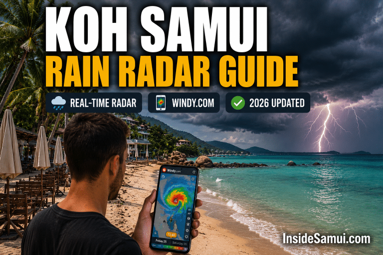
The Koh Samui rain radar is one of the most practical tools any visitor to the island can use — a real-time visual map of rain clouds moving across the Gulf of Thailand that tells you not just whether it will rain, but exactly when and from which direction.
Unlike a standard weather forecast that gives you a percentage probability, the Koh Samui rain radar shows the actual rain system in real time — allowing intelligent decisions about when to head to the beach, when to book a boat trip and when to plan an indoor afternoon. This complete guide covers the best radar tools for Koh Samui in 2026, how to read them and exactly how to use them.
According to Thailand's Meteorological Department, Koh Samui's rainfall is driven by two distinct monsoon systems — the northeast monsoon (October–December) and the southwest monsoon (May–September) — creating a weather pattern that makes real-time radar significantly more useful than standard long-range forecasts for day-to-day planning.
🎯 Book Flexible Koh Samui Activities — Klook →
Best Koh Samui Rain Radar Tools 2026
🌧️ Windy.com — Best overall · Animated rain radar · Shows Gulf of Thailand in real time · FREE
🇹🇭 Thai Met Dept Radar — Official Thai government radar · Most authoritative · FREE
🌦️ RainViewer — Global radar aggregator · Very precise · App available · FREE
📱 Weather.com App — Hourly rain maps · Easy to read · Good for beginners · FREE
📱 AccuWeather — MinuteCast feature · Minute-by-minute rain prediction · 2h window
How to Use the Koh Samui Rain Radar on Windy.com
Windy.com is the best Koh Samui rain radar tool for most visitors — it combines animated rain radar with wind forecasts, wave height maps and temperature layers in a single free interface. Here is exactly how to use it for Koh Samui:
- Go to windy.com and the map will open on your current location. Drag the map to Koh Samui (Gulf of Thailand, south of Bangkok) or search “Koh Samui” in the search bar.
- Select “Rain” from the menu on the left side of the screen. This switches the map overlay from wind to rainfall radar.
- Press Play on the time bar at the bottom of the screen to see the animated rain radar — watching the rain cells move across the Gulf of Thailand shows you exactly which direction the weather system is coming from and how fast it is moving toward Koh Samui.
- Check the Waves layer — switch to “Waves” to see the predicted wave height around Koh Samui. Wave height above 1.5 metres means most boat tours will cancel.
- Zoom to island level — zoom in on Koh Samui specifically to see whether the rain cell is targeting the east coast, west coast or the interior of the island.
Bookmark this direct Windy.com link — it opens the rain radar centred directly on Koh Samui. Save it to your phone's home screen for instant rain radar access without navigating the map every time. This is the most useful single URL for weather planning during your Koh Samui stay.
How to Read the Koh Samui Rain Radar
Understanding the colour coding on the Koh Samui rain radar is essential to interpreting what you see correctly:
| Radar Colour | Rainfall Intensity | What It Means for Koh Samui | Action |
|---|---|---|---|
| 🟢 Light green | Light rain · Drizzle | Brief light shower · Usually passes in 30 min | Wait it out · Continue planning |
| 🟡 Yellow | Moderate rain | Standard tropical shower · 30–90 min | Seek cover · Good time for lunch |
| 🟠 Orange | Heavy rain | Significant downpour · 1–3 hours possible | Move indoors · Cancel beach |
| 🔴 Red | Very heavy rain | Intense tropical rainstorm | Fully indoor day · Spa or activities |
| 🟣 Purple / White | Extreme rain | Tropical storm level · Rare on Koh Samui | Stay indoors · No travel |
Unlike European rain which can persist for hours of steady drizzle, tropical rain on Koh Samui is typically intense but brief. A red cell on the rain radar usually means 1–2 hours of heavy rain followed by clearing. If you see a large red cell approaching on the radar, plan an indoor lunch and wait — the afternoon will almost certainly clear. This is the most important thing to understand about using the Koh Samui rain radar effectively.
Koh Samui Rain Radar — East vs West Coast
One of the most valuable insights the Koh Samui rain radar provides is the ability to see whether rain is hitting one coast while the other remains clear. Koh Samui's central mountain ridge (Khao Pom, 635m) creates a genuine rain shadow effect — the two coasts frequently have completely different conditions simultaneously.
| Monsoon Period | East Coast (Chaweng · Lamai) | West Coast (Taling Ngam · Lipa Noi) | Radar Tip |
|---|---|---|---|
| Oct–Nov (NE Monsoon) | Heavy rain · Rough seas | Often sunny and calm | Watch for NE-approaching cells on radar |
| May–Sep (SW Monsoon) | Drier · Better conditions | More rain from SW systems | Watch for SW-approaching cells on radar |
| Dec–Apr (Dry Season) | Clear skies · Calm | Clear skies · Calm | Radar shows minimal activity |
During the October–November monsoon period, check the Koh Samui rain radar each morning. If you see heavy rain cells approaching from the northeast (targeting the east coast), consider switching your day's activities to the west coast. A 35-minute taxi to Taling Ngam or Lipa Noi frequently delivers sunshine while Chaweng is experiencing heavy rain. The radar makes this decision-making possible in real time.
Koh Samui Rain Radar — When to Check It
| When to Check | Why | What to Look For |
|---|---|---|
| Evening before a boat trip | Early warning of bad conditions | Large rain cells approaching from NE or SE |
| Morning of a boat trip | Final go/no-go decision | Clear Gulf between Koh Samui and Ang Thong |
| Before heading to beach | Plan timing | Any cells approaching in next 2–3 hours |
| During a morning swim | Watch for afternoon buildup | Developing cells inland · Heat-driven afternoon rain |
| When clouds build up | Estimate duration | Cell size and movement speed |
Koh Samui Rain Radar — Using It for Boat Trip Decisions
Boat trips to Ang Thong Marine Park, the Five Islands and Koh Phangan are the activities most affected by weather on Koh Samui — and the rain radar is your best tool for making the right call on whether to go or not.
The night before: Open Windy.com and check the 24-hour animated wind and rain radar for the Gulf of Thailand. If you see large rain cells moving toward Koh Samui from the northeast, or sustained wind above 15 knots forecast for your departure time, contact your tour operator and ask about their weather policy.
The morning of: Check the live radar at 7am — this is the most reliable indicator of actual conditions. If the Gulf between Koh Samui and Ang Thong is clear on the radar and wind forecasts show under 15 knots, conditions are almost certainly good enough for the tour to proceed. If large orange or red cells are visible on the radar over the Gulf, expect cancellation.
Always book boat trips and outdoor activities via Klook or GetYourGuide with free cancellation. Even with the Koh Samui rain radar, weather can change faster than expected. Free cancellation costs nothing and protects you from losing money if conditions deteriorate. Most Klook and GYG activities offer free cancellation up to 24 hours before departure.
🎯 Book Activities with Free Cancellation — Klook →
What to Do When the Koh Samui Rain Radar Shows Heavy Rain
The rain radar shows a big red cell heading for Koh Samui. Here is exactly what to do — by timing:
| Rain Duration (estimated from radar) | Best Activities | Where |
|---|---|---|
| 30–60 minutes (small cell) | Wait it out at a café · Smoothie break | Any beachfront café with cover |
| 1–2 hours (medium cell) | Thai massage · Lunch · Shopping | Chaweng mall · Any spa |
| Half day (large system) | Thai cooking class · Spa day | Resort spa · Cooking school |
| Full day (monsoon system) | Temple tour · Museum · Shopping · Spa marathon | Big Buddha · Fisherman's Village |
Koh Samui Rain Radar — Seasonal Guide
| Season | Radar Activity Level | What You See | Planning Impact |
|---|---|---|---|
| December–April (Dry) | Minimal | Clear Gulf · Occasional small coastal cells | Radar rarely needed · Conditions reliable |
| May–August (Transition) | Moderate | Afternoon cells building inland · Coastal development | Check morning radar · Plan am activities |
| September–October (Monsoon) | Heavy | Large persistent NE cells · Gulf churned | Daily radar essential · Have indoor backup |
| November (Transition) | Moderate–Heavy | Reducing NE cells · Improving late month | Check daily · Late November improves significantly |
Koh Samui Rain Radar — Practical Tips
- Bookmark the Windy.com Koh Samui link — save windy.com/?rain,9.530,100.060,10 to your phone home screen. It opens directly on the Koh Samui rain radar without any navigation.
- Check at 7am and 12pm daily — the two most useful checking times. Morning check plans the day; midday check refines afternoon activities.
- Use the animation feature — watching the radar animation over 6–12 hours tells you direction and speed of movement. A fast-moving small cell will pass in 30 minutes. A slow-moving large system will last hours.
- Cross-reference with wind — switch from rain radar to wind layer on Windy.com. Persistent wind above 15 knots combined with rain cells means rough sea conditions even after the rain passes.
- Thailand's meteorological radar updates every 6 minutes — for real-time accuracy during an active rain event, the TMD radar is more current than international services.
- Morning radar is more reliable than evening forecasts — the convective afternoon rain that builds over Koh Samui's interior is notoriously difficult to forecast more than 4–6 hours ahead. The morning radar gives you the most accurate same-day picture.
FAQ — Koh Samui Rain Radar
What is the best rain radar for Koh Samui?
The best rain radar for Koh Samui is Windy.com — it provides animated real-time rain radar centred on the Gulf of Thailand with wind and wave overlays, all for free. The Thai Meteorological Department radar (tmd.go.th) is the most authoritative official source and updates every 6 minutes. RainViewer is the best app alternative with global radar aggregation and a clean mobile interface.
How accurate is the Koh Samui rain radar?
The Koh Samui rain radar is highly accurate for the next 1–2 hours — you can see exactly where rain cells are and which direction they are moving. Beyond 6 hours, the radar becomes less reliable as new cells develop and existing ones dissipate. For planning purposes, treat 0–3 hours as high confidence, 3–6 hours as moderate confidence and anything beyond 6 hours as guidance only.
Does Koh Samui have a rain season?
Yes — Koh Samui's main rain season runs from October to November during the northeast monsoon. A secondary wet period occurs May to August during the southwest monsoon transition. The driest, sunniest period is December to April. The rain radar is most useful during the transitional months (May–August and November–December) when day-to-day variability is highest.
Can I still do boat trips if the Koh Samui rain radar shows rain?
It depends on the rain intensity and location. Light rain cells (green/yellow on radar) rarely cancel boat trips — the conditions are manageable and sea visibility often remains good. Heavy rain cells (orange/red) combined with high wind typically result in cancellations for safety reasons. Check the radar at 7am on the morning of your trip and contact your operator — most professional tour operators on Koh Samui make the final call based on actual conditions at departure time, not the previous evening's forecast.
Continue Reading
- Koh Samui Weather Forecast 14 Days — Complete Guide
- Best Time to Visit Koh Samui 2026
- Koh Samui Boat Trips — All Options Guide
- Best Snorkeling in Koh Samui 2026
- Cheap Hotels in Koh Samui — Last Minute Deals
Some links are affiliate links. InsideSamui.com earns a commission via Klook at no extra cost to you. Weather radar information based on publicly available tools. Updated 2026.